The Worst Neighborhoods in San Antonio are areas where crime rates significantly exceed both state and national averages, putting residents at heightened risk of violent crime and property theft. If you’re searching for safety information or considering a move—or an exit—from San Antonio, TX, understanding these high-risk areas is critical to protecting your family and financial future.
This guide ranks the most dangerous neighborhoods in San Antonio using a clear, repeatable method and publicly available neighborhood level crime rate estimates. It also links to its sources so you can double check conditions any time.
I’m Daniel Cabrera, with over 16 years in real estate, including experience with these neighborhoods. I aim to provide insights into the Most Dangerous Neighborhoods in San Antonio from a local perspective.
Based on current crime data analysis, here are the Worst Neighborhoods in San Antonio:
| Rank | Neighborhood | Violent per 100,000 | Property per 100,000 | Composite score | Safety percentile | Overall crime grade |
|---|---|---|---|---|---|---|
| 1 | Government Hill Alliance | 850.4 | 5652.0 | 2771.0 | 6th | F |
| 2 | Arena District | 920.9 | 5387.0 | 2707.3 | 8th | D |
| 3 | Denver Heights | 897.0 | 4836.0 | 2472.6 | 8th | D |
| 4 | Camelot | 687.8 | 4940.0 | 2388.7 | 9th | D |
| 5 | Rainbow Hills | 718.1 | 4439.0 | 2206.5 | 12th | D |
| 6 | Pipers Meadow | 673.2 | 4449.0 | 2183.5 | 13th | D |
| 7 | Prospect Hill | 783.3 | 4226.0 | 2160.4 | 14th | D |
| 8 | East Terrell Hills | 630.1 | 4223.0 | 2067.3 | 16th | D |
| 9 | Los Jardines | 700.6 | 3894.0 | 1978.0 | 18th | D |
| 10 | Pecan Valley | 661.9 | 3715.0 | 1883.1 | 21st | D |
| 11 | Community Workers Council | 677.2 | 3540.0 | 1822.3 | 22nd | D |
The crime grade and safety percentile are published on each neighborhood page on crimegrade.org.
If you want to know the San Antonio police calls by neighborhood, SAPD provides dashboards and data access through their Transparency and Open Data hub.
San Antonio Neighborhood Breakdowns
1. Government Hill Alliance
This ranks as the highest risk in this list by composite score, driven largely by property crime rate. The page reports an overall crime grade of F and a safety percentile of 6th.
If you are deciding where the worst part of San Antonio is for your situation, this is the type of profile you verify with current incident mapping because visitor heavy corridors can inflate counts.
2. Arena District
High violent and high property rates together push this near the top. The neighborhood page shows an overall D- grade and an 8th percentile safety ranking.
3. Denver Heights
If you are searching “is Denver Heights in San Antonio safe” or “Denver Heights San Antonio safe,” the data here shows a D- overall grade and 8th percentile safety ranking on the referenced neighborhood page.
Denver Heights is also a place where conditions can change block to block, so a single label can mislead.
4. Camelot
Camelot shows a D- overall grade, with property crime grading worse than violent in the referenced source.
When people ask “most dangerous part of San Antonio,” this is exactly why we split violent vs property instead of using a single vague “crime is high” statement.
5. Rainbow Hills
Rainbow Hills appears in many “San Antonio hoods” and “San Antonio dangerous areas” searches. In the referenced source it shows an overall D- grade and 12th percentile safety.
6. Pipers Meadow
The referenced page shows an overall D- grade and 13th percentile safety, with property and violent both elevated.
7. Prospect Hill
Prospect Hill shows an overall D- grade and 14th percentile safety on the referenced neighborhood page.
If you are asking “what parts of San Antonio are bad,” this is an example where the safer sections and higher incident sections can sit close together.
8. East Terrell Hills
East Terrell Hills shows an overall D grade and 16th percentile safety in the referenced data, with property crime carrying a large part of the risk.
9. Los Jardines
Los Jardines shows an overall D grade and 18th percentile safety in the referenced data.
10. Pecan Valley
Pecan Valley shows an overall D grade and 21st percentile safety in the referenced data.
11. Community Workers Council
Community Workers Council shows an overall D grade and 22nd percentile safety in the referenced data.
Why some areas show higher risk (without the hype)
When people search “ghetto San Antonio,” “San Antonio hood,” or “hoods in San Antonio,” they are usually trying to avoid risk, not write a sociology paper.
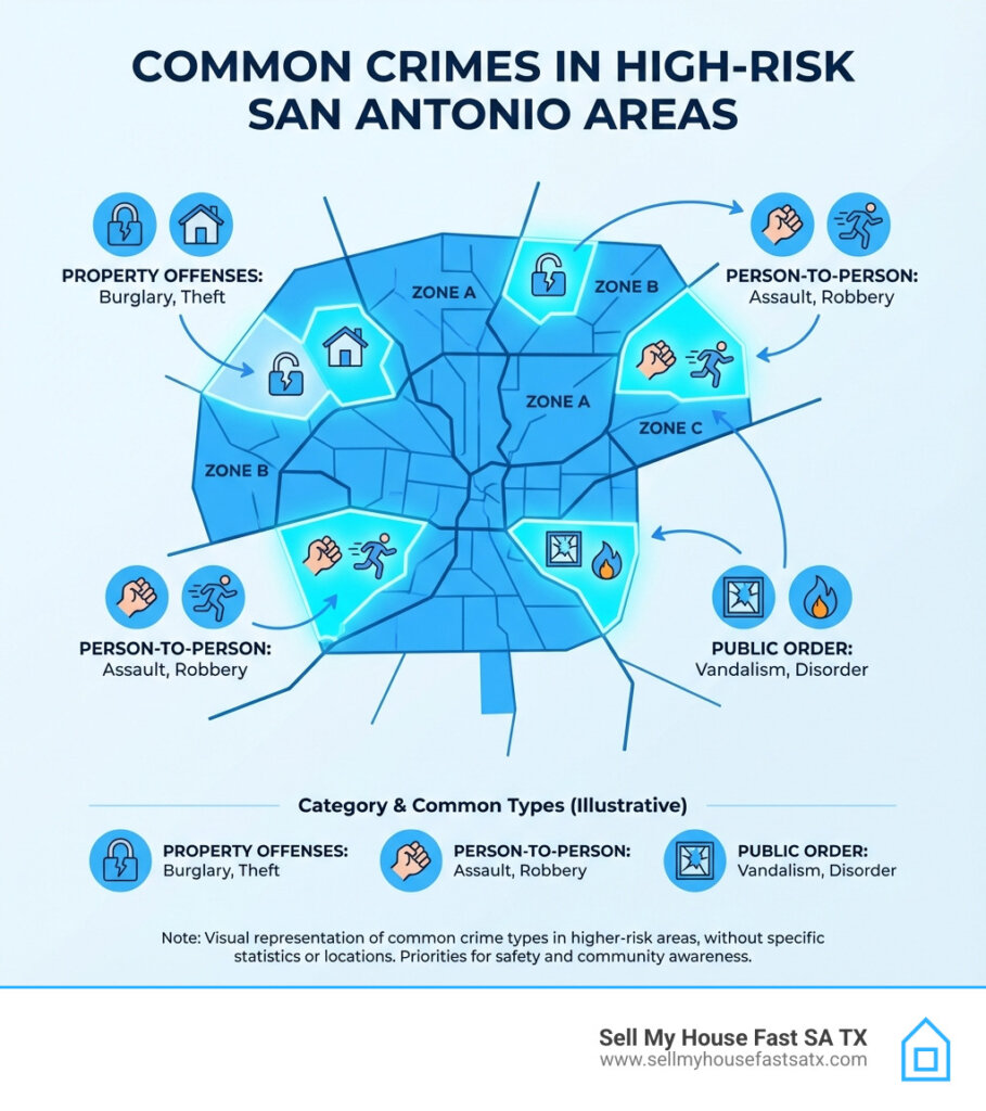
Higher incident density often correlates with a stack of real world factors:
- High traffic corridors and commercial strips where more opportunities exist for theft and conflict.
- Housing instability, vacancy, and neglected properties.
- Lower lighting coverage and weaker street infrastructure.
- Concentrated poverty and fewer local services.
San Antonio also uses targeted “hot spot” approaches in policing strategy discussions, focusing on small geographic areas rather than broad labels.
On citywide trends, SAPD leadership has publicly discussed declines in several categories in 2025 briefings and reporting, which is a reminder that rankings can change year to year.
How to Stay Safe in High-Risk Areas
Living in or near a high-crime area necessitates heightened awareness and proactive safety measures. Personal safety tips include remaining vigilant, avoiding walking alone at night, especially in poorly lit areas, and traveling in groups when possible. For your vehicle, always lock your doors, close windows, and never leave valuables in plain sight. Consider an alarm system or a steering wheel lock for added protection.
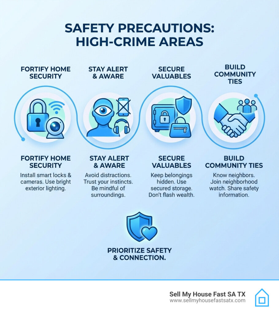
For your home, a robust security system with cameras, quality door and window locks, and well-lit exteriors can deter potential criminals. Researching neighborhoods thoroughly before moving is paramount, utilizing available data to understand the specific risks. Making informed decisions means weighing the benefits of a location against its safety profile. Sometimes, the peace of mind gained from living in a safer area outweighs other considerations. If you’re feeling the pressure of an unsafe environment, it might be time to consider the Signs It Might Be Time to Sell Your Home in San Antonio.
Avoid Walking Alone at Night
Walking alone at night in neighborhoods with high crime rates, like Denver Heights or Wheatley Heights, increases your vulnerability. Instead, try to travel in groups or use well-lit, busy streets. Consider using rideshare services or public transportation when available.
Secure Vehicles
Car theft and break-ins are common in areas like East Terrell Hills. Always lock your car doors and close windows when leaving your vehicle unattended. Avoid leaving valuables in plain sight; store them in the trunk or take them with you. Installing an alarm system or steering wheel lock can also deter thieves.
Community-Police Partnerships
Strong community-police relationships can significantly reduce crime. Residents in high-risk areas like Camelot and Los Jardines can participate in neighborhood watch programs. These initiatives foster communication between locals and law enforcement, creating a united front against crime. Reporting suspicious activity promptly and attending community meetings can further strengthen these partnerships.
By staying vigilant and working together, residents can help make San Antonio’s neighborhoods safer for everyone.
Frequently Asked Questions about Dangerous Neighborhoods in San Antonio
What are the most dangerous neighborhoods in San Antonio?
San Antonio, TX, has several neighborhoods with high crime rates. Pecan Valley, Denver Heights, and Wheatley Heights are among the most dangerous. In these areas, crime rates are significantly above the national average. Residents in Denver Heights, for example, face a crime rate above the national average. In Wheatley Heights, the risk of becoming a crime victim is 1 in 12, with common crimes including burglary, theft, and robbery.
Are there any safe areas in San Antonio?
Yes, there are safer neighborhoods in San Antonio. Oak Park-Northwood and Alamo Heights are known for their lower crime rates and strong community ties. These areas offer a more secure environment for families and individuals, with active neighborhood associations and community events that foster a sense of safety. Residents often cite the presence of good schools and well-maintained public spaces as additional benefits.
What is the poorest side of San Antonio?
The poorest areas in San Antonio are generally found central, east, west, and south of the city center. These regions face significant challenges, including high poverty rates and unemployment. The economic struggles in these areas often contribute to higher crime rates and urban decay. Efforts to revitalize these neighborhoods focus on addressing socio-economic disparities and improving access to resources, aiming to create a more equitable environment for all residents.
Is San Antonio, TX a dangerous city overall?
While San Antonio, TX’s overall crime rate is higher than the national average, it’s crucial to understand that crime is not evenly distributed. Many neighborhoods within San Antonio, TX, boast low crime rates and are considered very safe. The higher overall average is largely influenced by the concentrated crime in specific areas, such as the 11 Most Dangerous Neighborhoods in San Antonio. So, while parts of the city face significant challenges, safety varies greatly by location. It’s a city of diverse communities, and many offer a peaceful and secure environment.
How do the 11 most dangerous neighborhoods in San Antonio compare to safer areas?
The contrast is quite stark. The neighborhoods on our “most dangerous” list have crime rates ranging from 217% to over 500% above the national average, with residents facing a 1 in 7 to 1 in 12 chance of becoming a victim. In contrast, safer neighborhoods in San Antonio, TX, like Alamo Heights and Oak Park-Northwood, are known for their significantly lower crime rates. These areas often feature strong community ties, well-maintained public spaces, and active neighborhood associations that foster a sense of security and collective responsibility. They offer a more secure environment for families and individuals, a testament to how much safety can differ from one part of the city to another.
What is the San Antonio Police Department doing to address crime?
The San Antonio Police Department (SAPD) is actively engaged in various initiatives to combat crime, particularly in high-risk areas. Their strategies include ‘hot spot’ policing, which involves deploying resources to specific areas identified as having high crime concentrations. The SAPD has also implemented programs that involve deploying mental health professionals alongside officers to address incidents that may involve individuals in crisis, aiming for more appropriate and effective interventions. Furthermore, community engagement is a key focus, with efforts to build stronger relationships between law enforcement and residents. These proactive measures have shown positive results, contributing to a notable decrease in violent crime across San Antonio, TX, in recent years.
Where to find up to date crime data (official sources)
Even if you do not export tables, you can still verify current conditions:
- SAPD Transparency and Open Data hub
- SAPD Community Crime Map entry page
- FBI Crime Data Explorer (citywide context)
Conclusion
This site operates a home buying service. This article is informational and cites public sources for neighborhood crime estimates and official resources for verification.
If you want to sell your house in one of the worst San Antonio neignboorhoods, Request a Free, no-obligation, Cash Offer Today!